
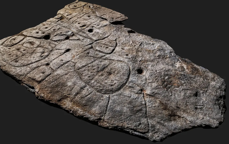
A slab of early-bronze-age French stone may be the oldest 3D map in Europe. That, at least, is what a new study from Bournemouth University, in France, reported in April of 2020.
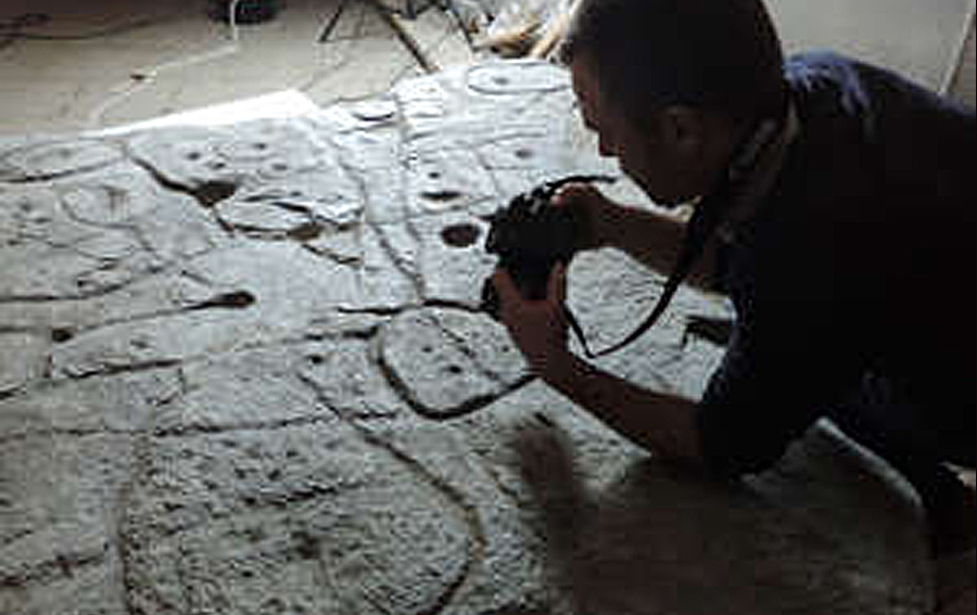
First discovered in 1900 by French archaeologist Paul du Châtellier, the artifact was lost until 2014, when it was rediscovered in a cellar beneath a moat of the museum’s chateau at Saint-Germain-en-Laye, northwest of Paris. Now experts from several French institutions, including Bournemouth have carried out a new study of the slab, and believe it is the real thing. Published in the journal Bulletin de la Société préhistorique française, the study says the slab is indeed “the oldest cartographical representation of a known territory in Europe, and a probable marker of the political power of a principality of the early Bronze Age.” (https://www.bournemouth.ac.uk/news/2021-04-06/researchers-discover-oldest-known-map-europe-saint-b-lec-slab).
Believed to represent an area in western Brittany from between 2150 and 1600 BC, the 2.2- x-1.53-meter ‘Saint-Bélec Slab’ is from the same period as the famous Nebra sky disk found in Germany, and thought by many to be the oldest known concrete depiction of the cosmos. The researchers think the new discovery reveals unexpectedly advanced cartographic knowledge in prehistory.
The Saint-Bélec Slab depicts, we are told, the territory of a strongly hierarchical political entity that tightly controlled a territory in the early Bronze Age, and that to break it may have indicated condemnation and deconsecration. The subsequent burial of the slab, is interpreted as an iconoclastic act and may have marked a rejection of the elites who exercised power over the society for several centuries during the early Bronze Age.
Curiously, even though trumpeted in the press as the oldest such 3D map in Europe, a seemingly much older artifact has been touted for years by some Russian researchers as even more remarkable.
In 2002 a scientists at Bashkir State University claimed to have found “infallible proof” of the existence of a highly developed civilization in the very ancient past. His evidence was a one-ton-plus stone slab (about five feet long, by three-and-a-half feet wide, and six inches thick) which he estimated to be, perhaps, millions of years old. The so-called Chandar Slab (aka the Dashka Stone) was located beneath the house of a local community leader in the town of Ufa. The slab’s surface was said to be a precisely detailed 3D relief map, which its discoverer had dubbed “The Map of the Creator,” of the Ural Mountain region.
Physics and mathematics professor Alexander Chuvyrov had been researching evidence of ancient Chinese influence in the area and had heard stories by early-20th-century investigators of several mysterious ancient slabs. Though interested, Chuvyrov had despaired of ever finding one himself, when the chairman of the local agricultural committee directed him to such a stone beneath his own house.
After a difficult recovery operation, Chuvyrov reported being startled to discover that the map accurately revealed many presently existing natural features, plus many which once existed but have now disappeared, including a system of channels, weirs and dams, as well as inscriptions in an unknown language (Chinese has been ruled out).
First discovered in July, 1999 the slab was, said the professor, subjected to numerous tests by Russian scientists. The results, based on radio carbon dating of shells embedded in the material, were baffling, to say the least, and not much could be said with certainty about the origin of the underlying stone. Chuvyrov had originally estimated the slab to be about 3,000 years old but later he came to believe it might be very much older.. The technical difficulty of creating such an accurate relief map, clearly, was far beyond the capability of any ancient culture previously believed to have occupied the region, or, indeed, any place on earth. Such a production would, in fact, be very difficult to replicate even with current technology (https://www.rbth.com/history/331654-russias-most-mysterious-discoveries).
Some investigators believe the slab may be a fragment of a complete map of the earth. A search for the missing pieces was claimed in 2002 to be in progress, but public viewing of the Chandar slab is no longer permitted.


